

Software


The biophysical data presented in terraGIS is the product of a series of steps which briefly involved the measurement, statistical modelling, interpolation and mapping of ancillary data and soil information. Whilst a detail description of these methods is not presented, in the following section the various software packages used are described. Further details of where the software can be obtained are also provided. Many of these software packages are described in detail in some of the research papers included in the Publications section of the terraGIS web page.
Programs
ArcView
During the 1980's the Environmental Systems Research Institute (ESRI) developed a core set of application tools that could be applied in a computer environment. The system focuses on the principle of organizing and analyzing geographic information. This is what is known today as geographic information system (GIS) technology. A GIS is a combined computer display of geographic features, such as points, lines, and polygons, with a database management tool for assigning attributes to these features. ArcView applies the principles of distributed processing and data management in a spatial context. For further details visit http://www.esri.com/index.html.
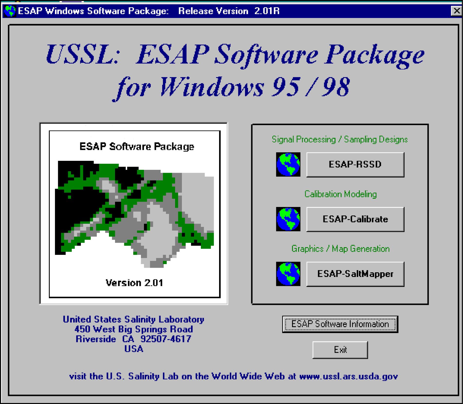
ESAP95
The ECe Sampling Assessment and Prediction (ESAP) is a software package which currently contains three programs. ESAP-RSSD (Response Surface Sampling Design) program generates soil sampling designs from bulk soil electrical conductivity survey information. The ESAP-Calibrate program estimates both stochastic and deterministic (soil theory based) calibration equations.The final program, ESAP-SaltMapper, can be used to produce high quality 1-D or 2-D graphical output of your EM survey data and/or predicted soil variables. For more information contact Mr Scott Lesch (slesch@ussl.ars.usda.gov) at the George E. Brown Junior Salinity Laboratory.
FuzME
Fuzzy k-MEans with extragrades (FUZME) is a program developed by the Australian Centre for Precision Agriculture (ACPA) at the University of Sydney for numerical clustering of multi-attribute point data. It was developed as an alternative to conventional classification systems. The technique is based on fuzzy set theory, which allows membership of an individual to belong totally, partially or not at all to a class. The program implements fuzzy k-means (FKM) and fuzzy k-means with extragrades (FKME). For more details contact Dr Budiman Minasny (budiman@mail.acss.usyd.edu.au) or visit the ACPA website at http://www.usyd.edu.au/agric/acpa/.systems.
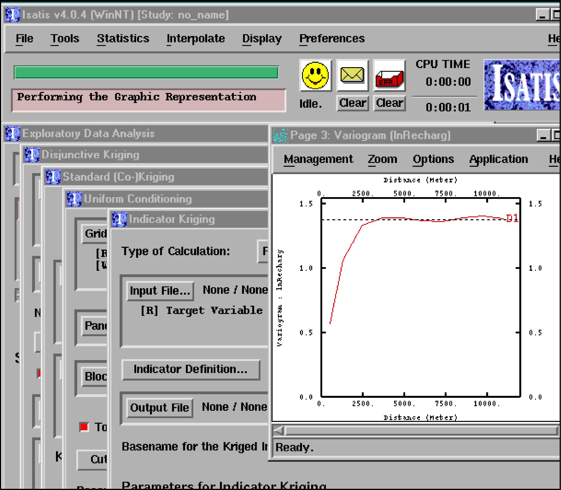
Isatis
Isatis offers geostatistical solutions that can be integrated into a Geographic Information System (GIS) framework. Isatis is characterized by its capability to achieve analysis on large multivariate data sets, with stationary and non-stationary techniques. In addition to classical kriging or cokriging methods, it provides non linear techniques like multi-indicator kriging or uniform conditioning. Moreover the integration of co-factors can be achieved by means of extended collocated cokriging or kriging with external drift also applicable with simulations. For more information regarding this software visit the Geovariances website at http://www.geovariances.com/.
JMP
This statistical software package is a SAS product that links statistics with graphics. The software is used by researchers, scientists and engineers. One of the key advantages of JMP is its ease of use through a comprehensive array to use menu driven visual analysis which enable the user to visualize and better understand their data. For more information regarding this software visit http://www.jmp.com/.
MapServer
MapServer is an Open Source development environment for building spatially-enabled internet applications. MapServer excels at rendering spatial data for the web. MapServer was originally developed by the University of Minnesota (UMN) ForNet project in cooperation with NASA and the Minnesota Department of Natural Resources (MNDNR). Presently, the project is hosted by the TerraSIP project, a NASA sponsored project between UMN and a consortium of land management interests. The software is maintained by a growing number of developers. For more information visit the University of Minnesota website at http://mapserver.gis.umn.edu/, or contact Mr Stephen Lime.
Neuroman
NeuroTheta was developed in order to provide a computer program capable of predicting soil water retention curve and saturated hydraulic conductivity from basic soil properties. The program used neural networks to predict water retention function from basic soil properties. The Neural networks were calibrated from Australian soil data using Neuroman. For more information regarding this software package contact Dr Budiman Minasny (budiman@mail.acss.usyd.edu.au).
SaLF
The Salt and Leaching Fraction (SaLF) model is based on the assumption that soil leaching or deep drainage is related to soil hydraulic conductivity, which in turn is influenced by the amount of clay (%), mineralogy (defined by CEC/Clay %) and exchangeable sodium percentage (ESP). Once these properties and water quality and quantity parameters have been determined the SaLF model can be used to estimate the rate of deep drainage or salt build-up at steady-state using various amounts or qualities of irrigation water. For more details contact Ms Rachael Zischke (zischker@nrm.qld.gov.au) from the Queensland Department of Natural Resources.
VESPER
Variogram Estimation and Spatial Prediction with Error (VESPER) is a program developed by the Australian Centre for Precision Agriculture (ACPA) for spatial prediction that is capable of performing kriging with local variograms. It was developed in order to interpolate measurements made by continuous yield monitors, mobile electrical conductivity systems, kinematic GPS and other ‘on-the-go’ field sensors within a single field. For more details contact Dr Budiman Minasny (budiman@mail.acss.usyd.edu.au) or visit the ACPA web site at The University of Sydney at: http://www.usyd.edu.au/su/agric/acpa/vesper/vesper.html.
© Copyright UNSW 2007 | Terms of use | Privacy Policy