

Legend menu bar
In order to view or change the biophysical data layer active within the terraGIS Custom map window, the user always needs to have the terraGIS Legend menu active.
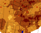
By default all the cadastral information available in each of the irrigated cotton growing areas available in terraGIS is always shown. This includes the location of water storage reservoirs, irrigated fields, roads and major water courses (e.g. rivers). These have been included to assist individual growers and consultants to orientate themselves but not directly identify a given landholding. At any point in time this information can be switched off by depressing the ‘None’ widget available for each cadastral layer.

In order to view any of the other biophysical data layers available in terraGIS the user simply needs to select the appropriate biophysical data layer from the Legend in the right hand panel of the terraGIS web page.
NOTE: Whilst several biophysical layers can be activated and be current, if the biophysical layer of interest lies below an already active layer in the Legend list, the biophysical data layer lower down the order will not be visible until the upper biophysical layer(s) is switched to the “None” position.
There are several types of biophysical information that can be viewed. This includes the;
Soil sample locations,
Ancillary Data,
Soil Properties, and
Hydrological Properties.
Soil sampling locations
The soil sampling locations collected in each of the study areas and which underpin the various biophysical data layers can be viewed by placing the cursor over the right facing triangle or the script Soil Sample Location.

Ancillary data
The spatial distribution of the various sources of ancillary data collected in each of the study areas and which underpin the various biophysical data layers can be viewed by placing the cursor over the right facing triangle or the script Ancillary Data.
The ancillary data that an be viewed includes;
- Electromagnetic data,
- Gamma spectrometry, and
- Topography

Soil Properties
The spatial distribution of the various biophysical data layers generated in each of the study areas can be viewed by placing the cursor over the right facing triangle or the appropriate script Soil Properties. Each of these biophysical data sets can be viewed at various depths of 0-0.30 (Topsoil), 0.30-0.60 (Subsurface), 0.60-0.90 (Subsoil), 0-0.90 (Root zone) and 6-12 m (Vadose zone).
The biophysical data layers that can be viewed include;
- Texture,
- Chemical,
- Cations,
- Stability, and
- Water.

Hydrological Properties
The spatial distribution of the various biophysical data layers generated in each of the study areas can be viewed by placing the cursor over the right facing triangle or the appropriate script Hydrological Properties. Each of these biophysical data sets can be viewed at various irrigation water volumes and estimated groundwater recharge rate. Where available water table height predictions were also made for areas such as Trangie, Warren and bourke where sufficient data was available.
The biophysical data layers that can be viewed include;
- Deep drainage,
- Groundwater recharge rate, and
- Groundwater table height.

© Copyright UNSW 2007 | Terms of use | Privacy Policy